Travel
Siang Valley, Arunachal Pradesh: Following the River Through Upper Arunachal
Admin
Author
August 19, 2026
5 min read
78 views
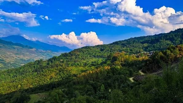
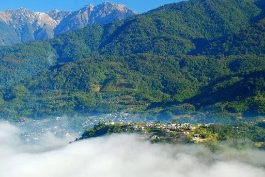
Siang Valley is best understood through the river that gives the region its identity. Flowing through the mountains of Arunachal Pradesh, the Siang forms a dramatic corridor of forested hills, river gorges, indigenous settlements and high-altitude landscapes. The journey through the valley connects places such as Pasighat, Pangin, Jengging, Yingkiong and Tuting, gradually moving from the lower river country into the rugged terrain of Upper Siang. Rather than being a single sightseeing destination, Siang Valley is a geographical and cultural journey shaped by the river. Its landscape changes noticeably along the route—from broad river valleys and settlements around Pasighat to steep forested mountains and powerful river corridors near Tuting.
The River That Shapes the Valley
The Siang enters Arunachal Pradesh from Tibet, where it is known as the Yarlung Tsangpo. After entering India, the river flows southward through Arunachal Pradesh before eventually becoming part of the Brahmaputra system in Assam. Its course through the mountains has created deep gorges, rapids and densely forested valleys. The river is also central to the region's adventure tourism. The upper stretches around Tuting are particularly associated with white-water expeditions, while the wider river corridor supports fishing, riverside travel and exploration.
Pasighat: The Starting Point
At around 155 metres above sea level, Pasighat provides an important entry point into the Siang region and serves as the headquarters of East Siang district. The town lies close to the Siang and is associated with several attractions, including Sirki Waterfall, Raneghat, Komlighat and the Pongging hanging bridge. Pasighat also provides access to the Daying Ering Wildlife Sanctuary, a riverine sanctuary known for its forested islands and birdlife. The sanctuary can be explored by cruising along the Siang, with migratory cranes, ducks, storks and other waterbirds appearing seasonally.
Pangin: Where Two Rivers Meet
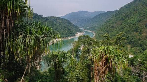
Around 60 km from Pasighat, Pangin occupies a particularly striking geographical position at the meeting point of the Siyom and Siang rivers. This confluence is one of the region's defining landscapes, with the two waterways coming together beneath forested mountain slopes. Pangin is also associated with the Adi community, making it an important stop for understanding the relationship between the river landscape and local settlement patterns. Traditional bamboo bridges and the surrounding river scenery add another dimension to the experience.
Kekar Monying: A Landscape With History
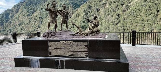
The Siang region is not only defined by its natural geography. At Kekar Monying, near Rottung, the landscape carries an important chapter of colonial-era history. Known as Black Rock, the prominent cliff was the site of resistance by Adi communities against British forces on 4 December 1911. The rock itself is approximately 50 metres high and 500 metres long, making it both a geographical landmark and a historical site. Nearby Komsing is also associated with the killing of British political officer Noel Williamson and contains a stone epitaph commemorating the event.
Yingkiong and the Cultural Landscape
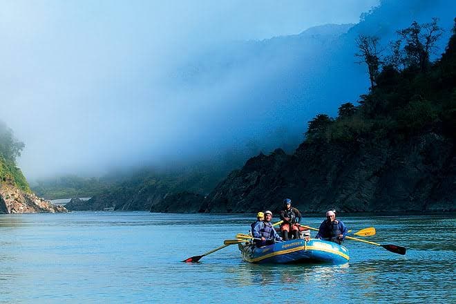
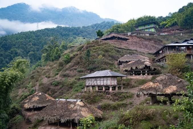
Further north lies Yingkiong, the headquarters of Upper Siang district. Here, the Siang landscape is closely intertwined with indigenous communities and their traditional ways of life. The Adi community has a particularly strong presence across the region, with agriculture, weaving, traditional practices and community festivals forming important parts of the cultural landscape. The wider Upper Siang region also includes Memba and Khamba communities, particularly towards the higher reaches around Tuting. This cultural diversity becomes more visible as the route progresses north, where indigenous traditions meet the Buddhist heritage of the upper Siang and Pemako region.
Mouling National Park: Into the High Forests
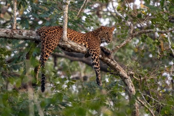
As the journey moves towards Jengging and Upper Siang, the landscape becomes increasingly rugged. Mouling National Park is one of the major ecological highlights of the region. Established in 1986, the park covers approximately 483 sq km and extends primarily across Upper Siang, with portions in West Siang and East Siang. Its terrain ranges from around 750 metres to 3,064 metres at Mouling Peak, creating several distinct ecological zones. The park provides habitat for species including takin, serow, goral, clouded leopard, black bear and red panda, along with a diverse range of birds and plant species. The forest landscape also includes orchids and waterfalls, while trekking and nature walks are among the activities associated with the park. Access remains challenging because of the park's remote terrain. The forest department identifies approaches through the Ramsing range from Bomdo village and the Jengging range from Lissing village, highlighting just how different Mouling is from more easily accessible national parks.
The strength of Siang Valley lies in the way several landscapes come together along one route. It combines the broad river environment of Pasighat, the confluence at Pangin, the historical landscape of Kekar Monying, the biodiversity of Mouling National Park, the indigenous cultural landscape around Yingkiong and the high mountain river corridors of Tuting and Gelling. It is therefore better experienced as a river journey through changing landscapes, rather than as a destination centred around one famous viewpoint. For travellers interested in slow travel, indigenous cultures, wildlife, river landscapes and less conventional routes through Arunachal Pradesh, Siang Valley offers a particularly layered experience—one where geography, history and everyday life remain closely connected to the river.
Share this article:
About Admin
Travel enthusiast and writer sharing stories from around the world. Passionate about discovering hidden gems and cultural experiences that inspire wanderlust.